Body text
Air pollution seen from a satellite …
NO2 is an atmospheric pollutant with direct adverse effects on human health. Through its role in atmospheric chemistry, it is also a precursor of other key air quality indicators such as surface (‘bad’) ozone and particulate matter. In mid-latitude urban areas, NO2 mainly originates from:
- combustion engines
- fossil fuel-based production of heat and electricity.
Due to its absorption in the visible spectrum, it is possible to remotely quantify NO2. This is done from ground, from aircraft, or from space, using the so-called DOAS (Differential Optical Absorption Spectroscopy) technique.
The DOAS method is used to produce daily global NO2 maps with the TROPOMI satellite instrument onboard the S5p satellite. Such maps shed light on the NO2 distribution at the global scale, yet the spatial resolution is coarse (5.5x3.5 km2).
Moreover, the calibration and validation of the satellite measurements are crucial for optimizing the data quality and thus for taking informed decisions to improve air quality.
… appears clearer from an aircraft
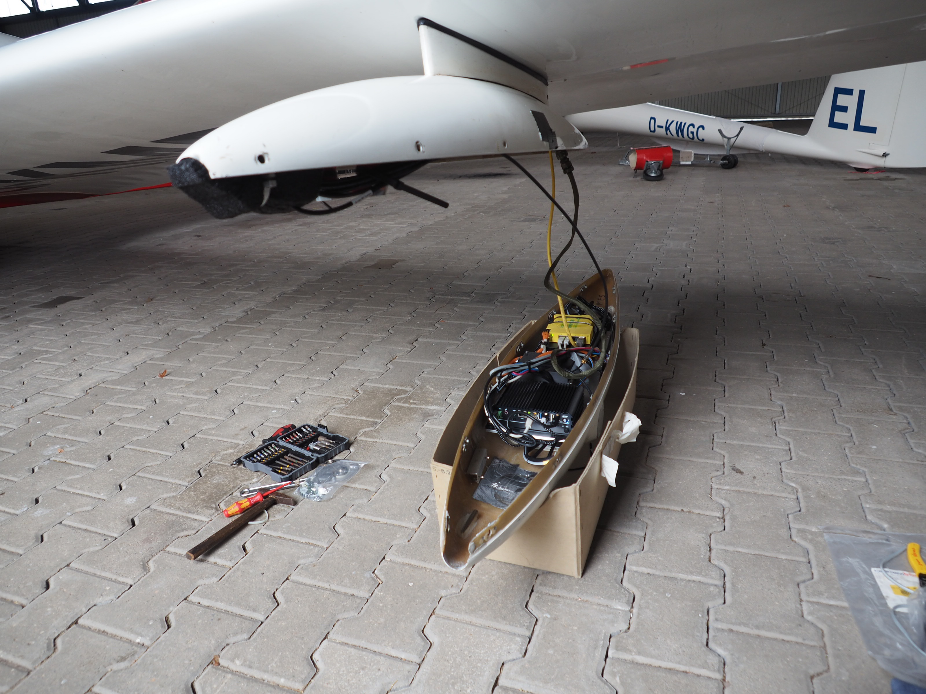
In the context of the validation of TROPOMI/S5P, BIRA-IASB developed the compact SWING instrument. This device acquires nadir UV-visible spectra, scanning the air under the aircraft perpendicularly to the flight direction, following the whiskbroom principle.
Using the same DOAS technique as TROPOMI, it also produces maps of NO2, but at a much higher spatial resolution of typically 150 m. SWING was developed for the weight and volume requirements of Unmanned Aerial Vehicles (UAVs) and is hence very compact. This eases its integration in larger manned aircraft, possibly with a set of other scientific instruments.
We have equipped several research aircraft with in-house developed SWING-type of instruments:
- a Cessna-207 and a motor glider from the Free University of Berlin (FUB, Germany),
- a Britten-Norman 2 from the National Institute for Aerospace Research "Elie Carafoli” (INCAS, Romania).
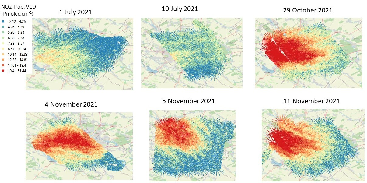
In 2021 and 2022, ESA supported SWING experiments for regular airborne mappings of NO2 over Berlin (12 flights) and Bucharest (18 flights).
This unique dataset covers the four seasons. This makes it particularly valuable for TROPOMI validation but also for other applications such as the quantification of the urban NO2 flux, as the latter significantly varies across the year.